Scientific Research
Research Overview
The Guangdong-Hong Kong-Macau Greater Bay Area (GBA) in the Pearl River Delta (Fig. 1) covers ~80,000 km2 of land, ocean area and the broad Pearl River Basin (PRB) that crosses six provinces in southern China over an area of 440,000 km2. With a population exceeding 80 million, the GBA is one of the global economic powerhouses, while the contiguous PRB is home to 124 million people and provides essential societal, ecological, and economic services to the GBA. The GBA currently faces the pressing environmental challenge of providing and sustaining a healthy and resilient environment for the millions for its millions of residents under the accelerating climate change, rapid economic development, and a new national initiative to transform it into a technology and innovation hub in the GBA.
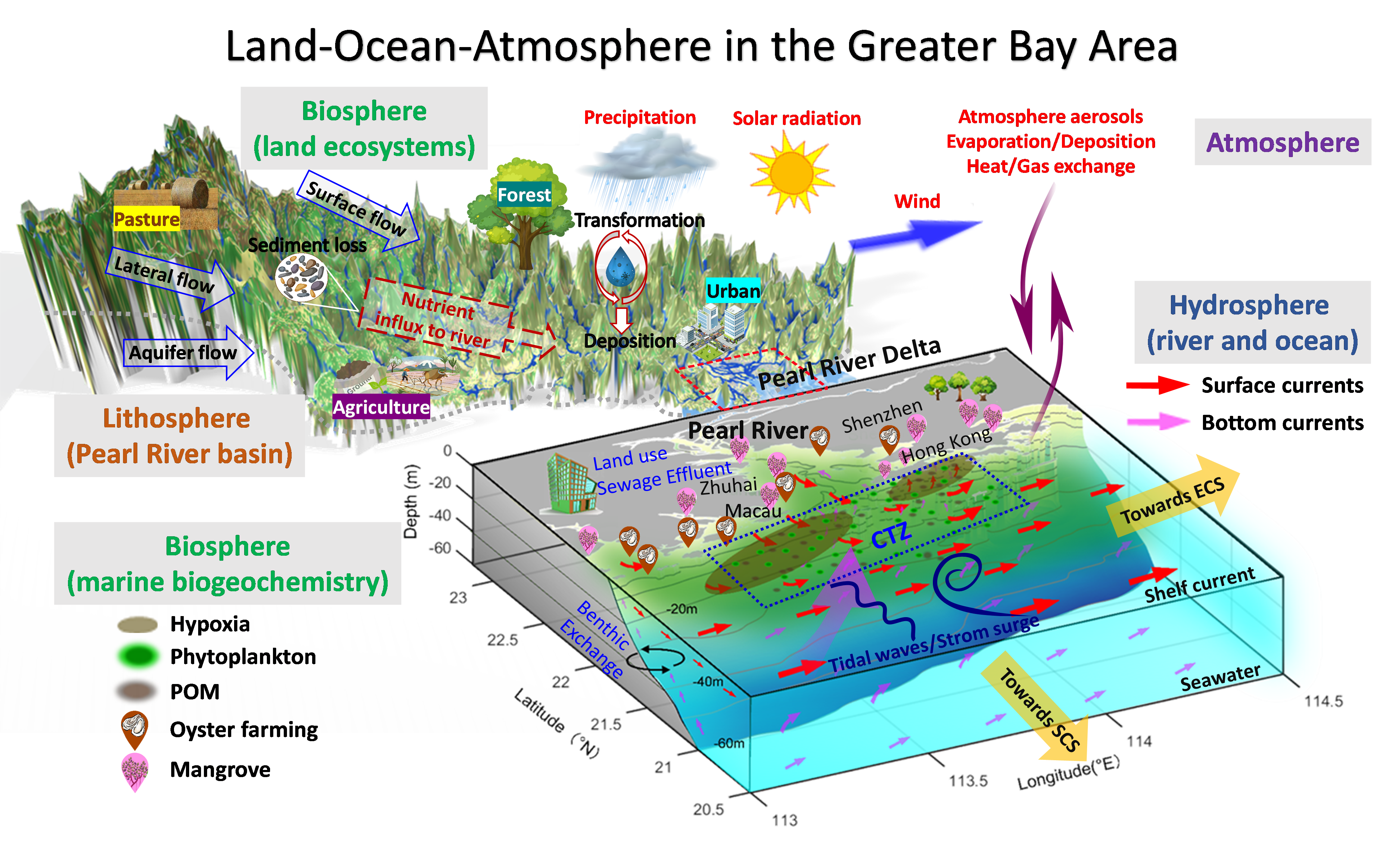
The GBA waters include the Pearl River (PR) network in the river basin, the Pearl River Estuary (PRE), the coastal embayment of Hong Kong waters (HKW), and the adjacent continental shelf sea (Fig. 1). These waters run through the PRB by the PR on the land, connect to the broader South China Sea (SCS), and are greatly affected by the prevailing southeast Asia monsoonal winds and atmospheric heat and moisture fluxes (evaporation and precipitation). Collectively, these interlinked multi-spheric processes form a regional earth system (RES) (Fig. 1), including aspects of the lithosphere (land, PRB), the hydrosphere (PR, PRE and adjacent ocean), the atmosphere and the embedded biosphere. The pathways, interactions, cycles, and feedbacks of the processes in the RES occur within and among different spheres through transfer and transport of material and energy fluxes. Despite its complexity, a scientific understanding, assessment and prediction of change to the RES, either by natural processes, climate change or human activity, are required for designing strategies for adaptation and management of the environmental challenges in the GBA.