Recently, the research team led by Prof. Yi Liu from the Earth, Ocean and Atmospheric Science (EOAS) Thrust, HKUST (GZ) has completed a field survey on the small water bodies (SWBs) in the Guangdong–Hong Kong–Macao Greater Bay Area (GBA). Over the past 30 days, the field survey covered nine prefecture-level cities (excluding Hong Kong and Macao), delving into the greenhouse gas (GHG) dynamics of various types of small water bodies as well as the multifaceted effects of human activities. This field survey was supported by the Centre for Ocean Research in Hong Kong and Macao (CORE) and the Hong Kong Research Grants Council's 2023/24 Area of Excellence (AoE) project “Study of the regional earth system for sustainable development under climate change in the Greater Bay Area”(AoE/P-601/23-N).
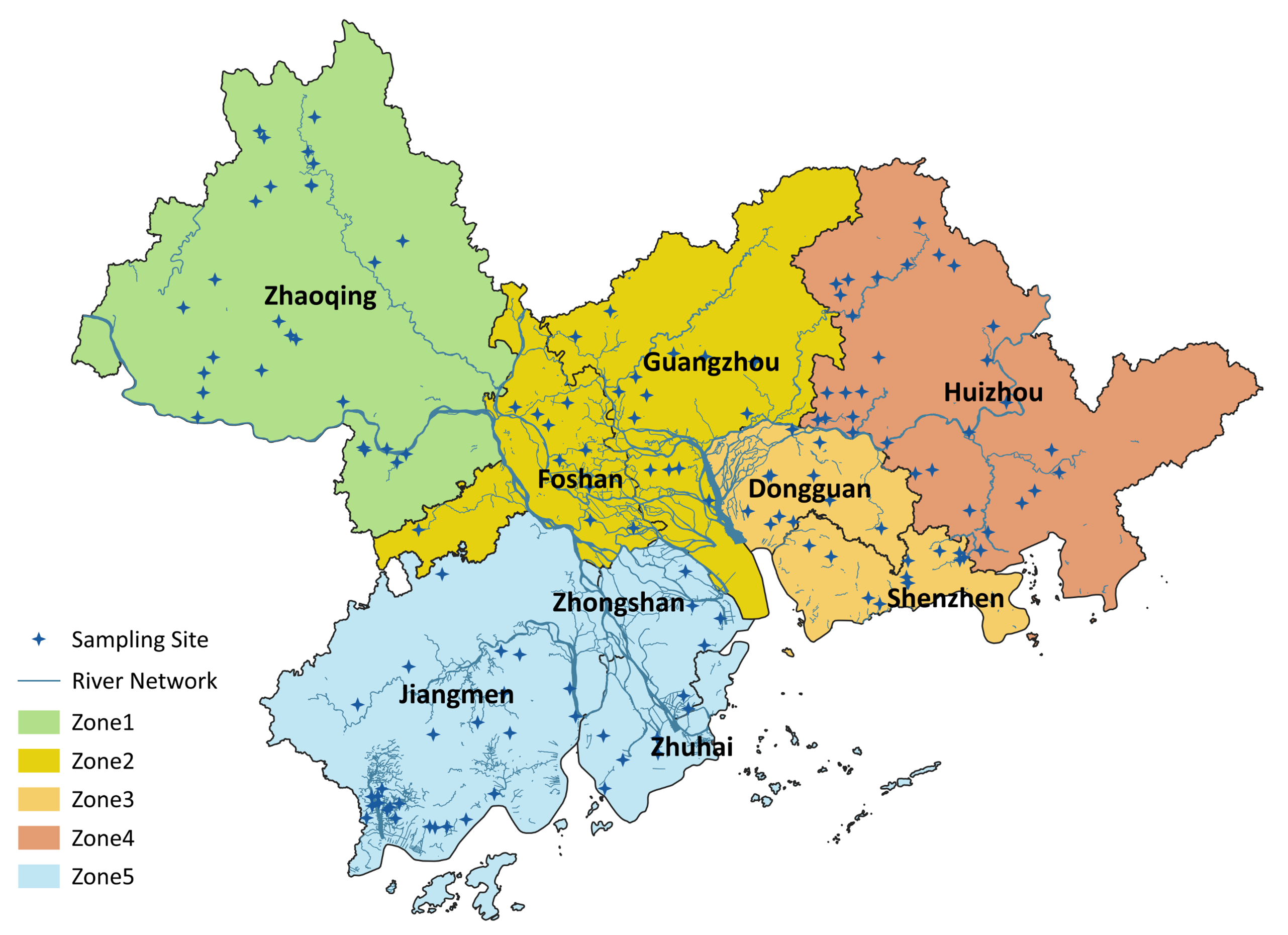
Figure 1. Distribution of Sampling Points for Scientific Investigation of Small Water Bodies in the Guangdong-Hong Kong-Macao Greater Bay Area
Research Background
The GBA , situated in the lower reaches of the Pearl River Basin, encompasses nine prefecture-level cities (Guangzhou, Shenzhen, Zhuhai, Foshan, Huizhou, Dongguan, Zhongshan, Jiangmen, and Zhaoqing) along with the Hong Kong and Macao Special Administrative Regions. As one of China's most important regional economic hubs, the GBA accounts for 6% of the country's population and 9.5% of its GDP. The rapid economic growth in the region has accelerated urbanization and other anthropogenic activities, placing mounting pressure on the natural environment. SWBs play a crucial role in providing habitats for aquatic organisms and migratory birds while performing vital ecological and environmental functions. However, these SWBs are particularly vulnerable to human disturbances, such as land-use change and pollutant inputs and climate change due to their small size. More importantly, SWBs may act as hotspots for carbon and nitrogen cycling and GHG emissions. Despite their environmental and ecological importance, SWBs are often overlooked in monitoring programs due to their vast numbers and wide distribution.
Survey Content
This survey focused on SWBs (<100 ha) in the GBA. The team selected over 150 sampling sites, including natural ponds, urban ponds, and aquaculture ponds, to investigate: (1) GHG emission dynamics; (2) Nitrogen removal capacity; (3) Microplastic pollution characteristics. In addition to water and sediment sample collection, the team also measured the environmental parameters on sites with portable devices. In-depth interviews with local waterbody managers were conducted during the field sampling to document the usage patterns and management practices. Furthermore, leveraging a DJI M350 RTK drone equipped with the H30T payload, the team carried out automated aerial surveys and thermal-infrared remote-sensing experiments to faciliate future quantitative retrieval of water-body parameters from satellite imagery.
Research Team
This scientific investigation was led by Prof. Yi Liu's research group, in collaboration with interdisciplinary research teams across the GBA.
Participants included:
- Yuke LI, Xinke LI, Huanglin LUO, Cheng XING, Junkai LING, and Yan ZHANG — from Prof. Yi LIU's group, EOAS, HKUST (GZ).
- Zhijie ZHOU — from the Urban Governance and Design Thrust, HKUST (GZ).
- Zhiyan CHEN— from Prof. Ding HE's lab, OCES, HKUST.
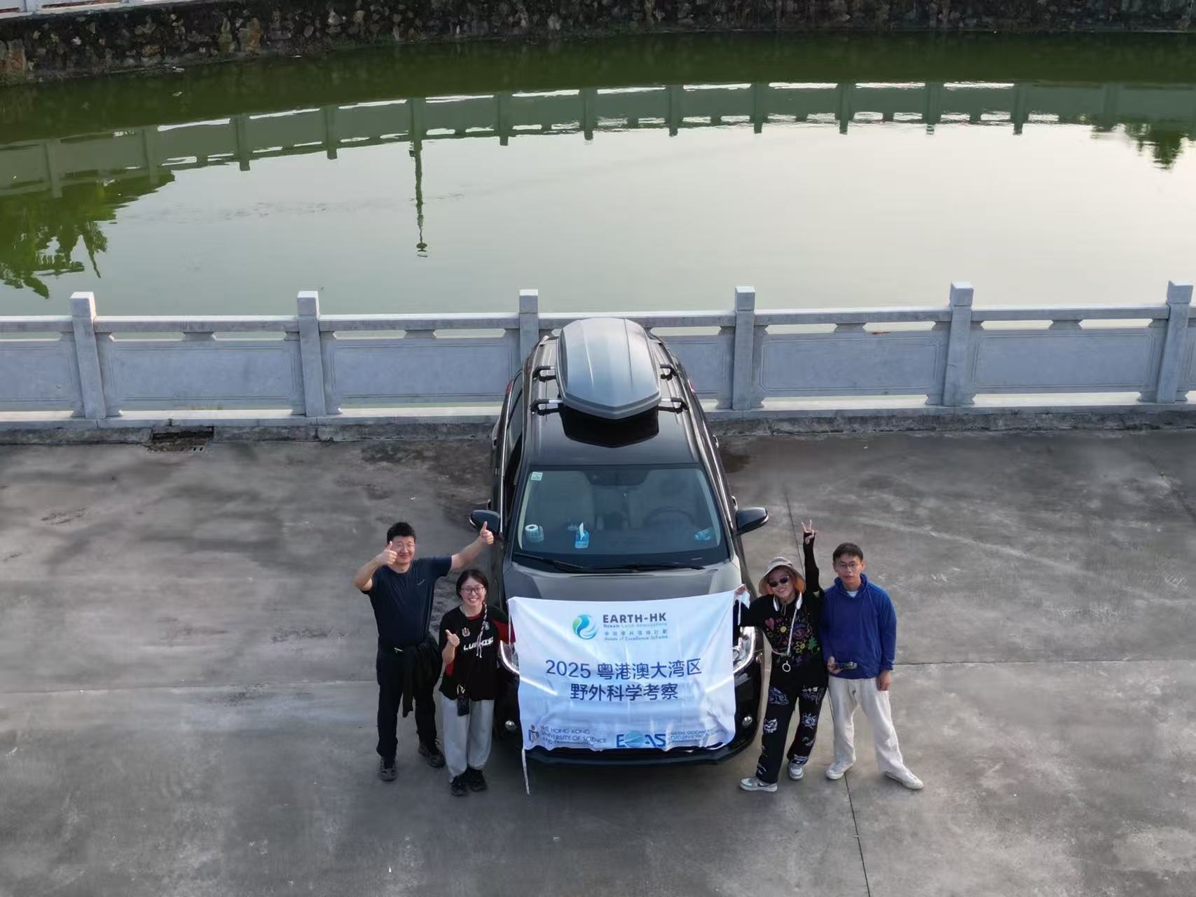
Members of the field sampling team
(Start from the left: Yi LIU, Xinke LI, Yuke LI, Huanglin LUO)
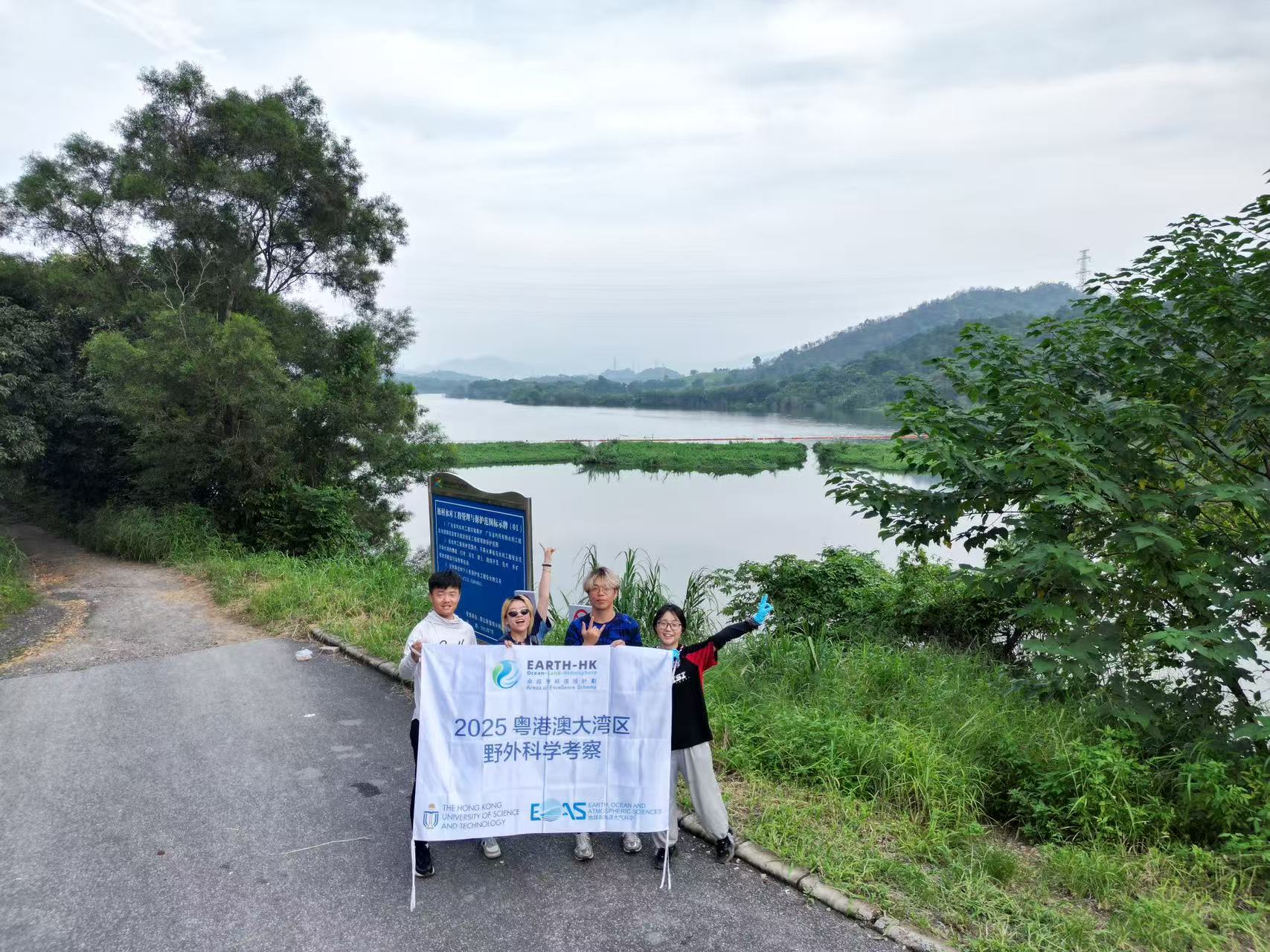
Members of the field sampling team
(Start from the left: Cheng XING, Yuke LI, Junkai LING, Xinke LI)
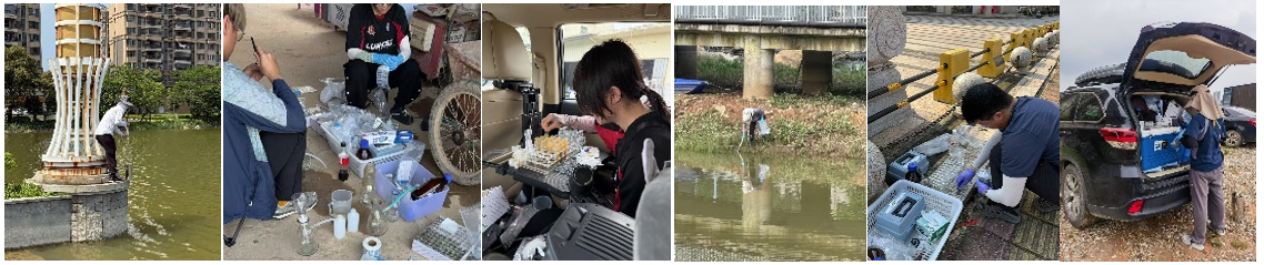
Snapshot of Fieldwork
(From left to right: Water collection; Pre-treatment of water samples; On-site cultivation experiment; Sampling of sediments; Alkalinity titration; Filtration experiment)
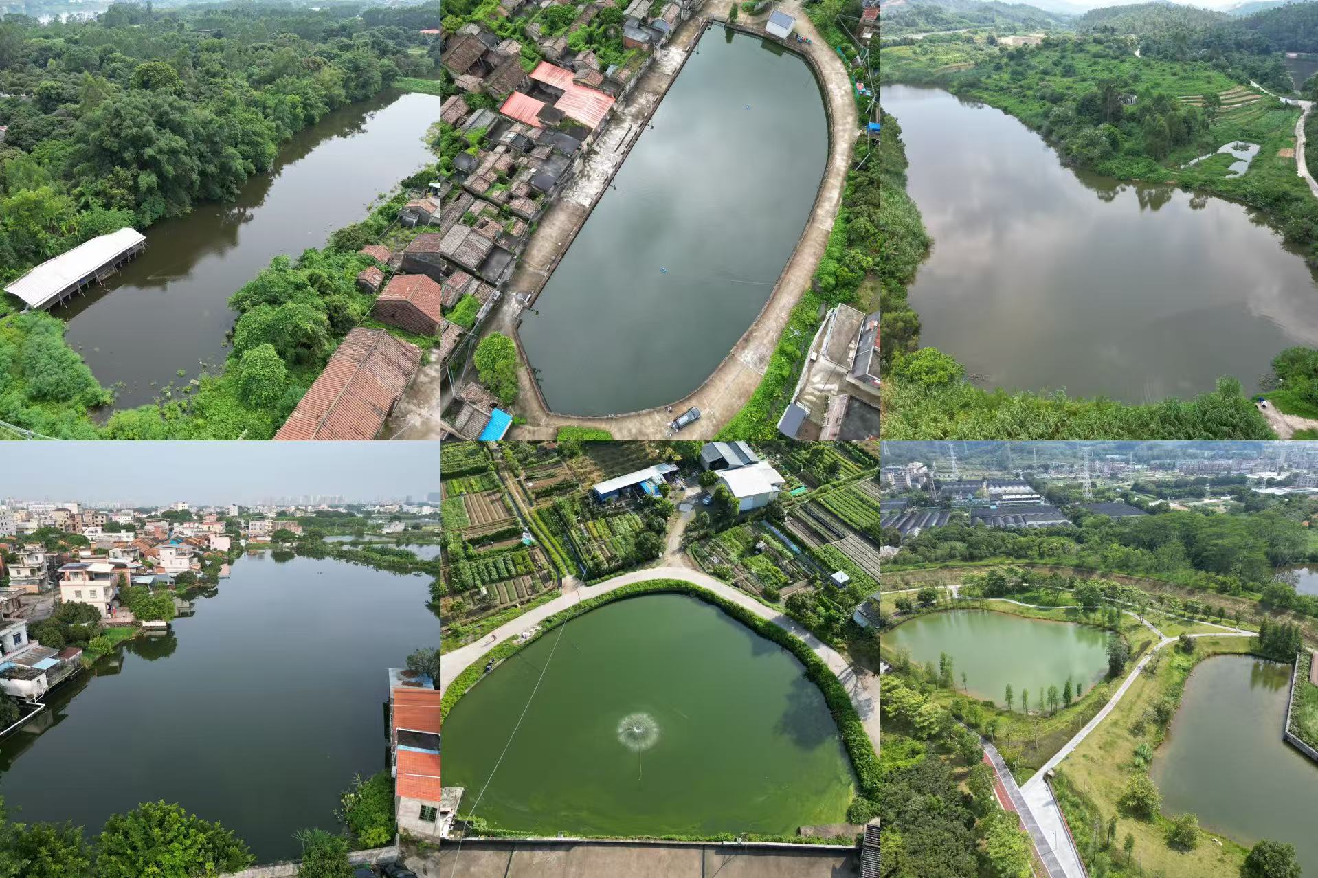
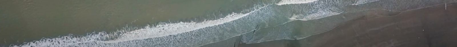
Images captured by the unmanned aerial vehicle (UAV) sampling small water bodies
(With DJI Mini3 Pro)
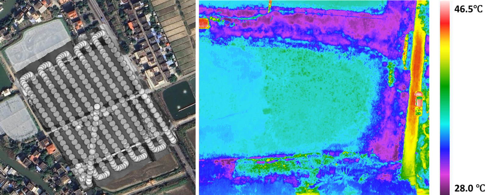
Using UAV equipped with thermal infrared for two-dimensional surface temperature modeling: (Left) flight route; (Right) thermal infrared image
(With DJI M350RTK & H30T)